 Marrakech Guidebook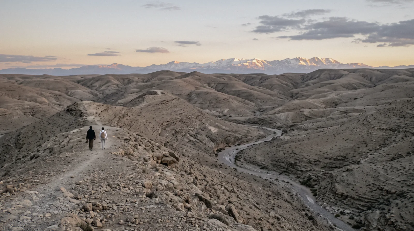
Agafay Desert
The Agafay desert is a run of bare limestone hills 26.5 km south-west of Jemaa el-Fna, about 35 minutes by road, and it is a legally constituted Moroccan commune of 17,771 people before it is anything a tour sells. There is no entry fee, no gate, no managing body and no page about it on the national tourist board's site at all. This page sets out what can actually be sourced about the ground, the roads, the dam next door and the camps, and it says plainly which of the popular descriptions cannot be attributed to anybody. The rest of the days out of the city are on the day trips index, and what the city itself holds is on the homepage.
Quick answer Where it is, what it costs, what the ground actually is, and what it is not
Agafay is a real Moroccan commune of 17,771 people in the Cercle de Loudaya, 26.5 km and about 35 minutes from Jemaa el-Fna by road. It has no entry fee, no managing body and no scheduled transport, and the national tourist board publishes no page about the desert at all.
Key takeaways
- It is not the Sahara and it is not sand. The dunes people picture are at Merzouga, 553 km east, and no official or academic source describes the Agafay ground with either of the geological words the guidebooks use
- What sells here is an evening rather than a sight: a sunset camel ride with dinner and a show is listed at $16.59, a quad and camel package at $23 and a night in a tented camp with a pool at $64.02
- The one thing nearby with a documented record is the Lalla Takerkoust dam, working since 1935, 71 metres high, 96 million cubic metres and 27.6 per cent silted, 35.6 km out by road
- If you want water and walnut terraces instead of stone, the Ourika valley is an hour further on, and all eight days out are compared here on drive time and fare
Key facts
Opening hours
| Open country on unclassified tracks. No gate, no ticket office and no published opening hours | |
|---|---|
| Camps and activity bases set their own hours; the trips are timed to sunset and dinner |
Closed None published. There is no managing body to close it
Admission
- Adult
- Free. No Moroccan authority publishes an entry fee, a permit or an access charge for Agafay, and no protected-area status or managing body appears in any document we found
- Reduced
- Not applicable, because there is no ticket
- Free
- The ground itself. What costs money is the vehicle, the camp and the activity, each priced by a private operator
Planning it
- Time needed
- Not stated by any authority. Our routing: four hours for the sunset evening, about seven with quads, and 35 minutes of it is the drive each way
- Book ahead
- Recommended — a few days
- Address
- Commune rurale d'Agafay, Cercle de Loudaya, Prefecture de Marrakech, Region Marrakech-Safi
Nothing admits you to Agafay, so this compares the ways of getting there and what each one costs. Camp prices are the GetYourGuide listings read in Q3 2026; the first row is what the ground itself charges, which is nothing at all, on the authority of every Moroccan source that fails to mention a fee.
Are you buying a landscape, or an evening with dinner in it?
| Option | What it costs | Includes | Cancel | Book |
|---|---|---|---|---|
| Drive out yourself, there is no ticketAnyone with a vehicle who wants the ridge at sunset and no dinner attached | Free at the site; you pay only the vehicle | No fee, no permit, no gate and no managing body in any Moroccan document | Nothing to cancel | Official site |
| Sunset camel ride and dinner showThe default choice: four hours, a camel, the sunset and a table | $16.59 listed | Hotel pickup, camel ride, dinner and entertainment, about 4 hours | Free up to 24 hours before | Check Availability |
| Quad ride, camel ride and dinner showAnyone who wants the quad as well and has the whole afternoon free | $23 listed | Transport, quad with briefing, camel ride, dinner show, about 7 hours | Free up to 24 hours before | Check Availability |
| Overnight in a tented camp with a poolPeople who want the sunrise as well, and a pool between the two | $64.02 listed | Transfer, tent, three-course dinner, show, pool, about 19 hours | Free up to 24 hours before | Check Availability |
The overnight operator states that unmarried Moroccan and Muslim couples cannot share a tent or a dormitory, which is a condition you meet at check-in rather than at checkout. Camps also sell their own evenings directly and publish no rate card we could read, so the listed prices above are the only ones in the open. Listed figures move with the date; the number you pay is the one the checkout shows.
The Three Agafay Evenings, Compared
Three products that end at the same ridge and differ mainly in how much of the day they take. Prices are the GetYourGuide listings read in Q3 2026 in US dollars as the platform shows them; ratings and review counts are the platform's own.
 from $16.59
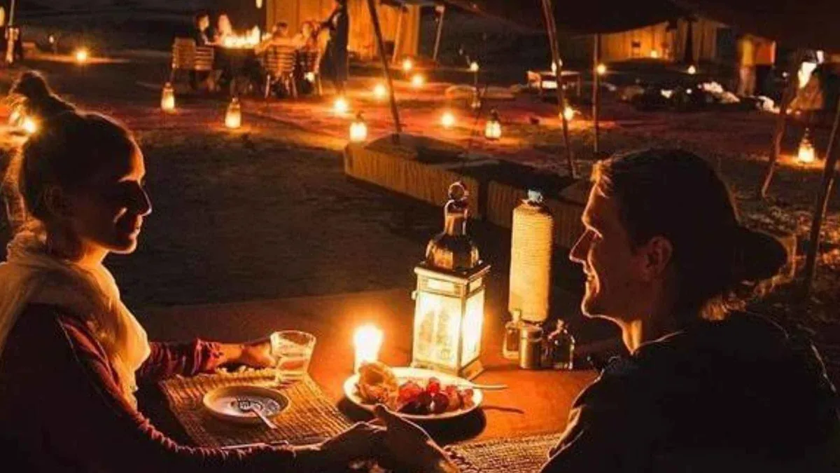
Marrakech: Agafay Desert Sunset, Camel Ride, and Dinner Show
listed at $16.59
Four-hour late-afternoon trip to an Agafay camp for a camel ride, sunset and a dinner show, pickup included. Shorter and cheaper than the full quad packages.
Check Availability from $23
Marrakech: Agafay Desert Quad & Camel Rides with Dinner Show
listed at $23
Seven-hour Agafay outing combining a quad ride, a camel ride and a dinner show at a desert camp, with pickup from a meeting point. The stony Agafay is an hour from town, not the Sahara.
Check Availability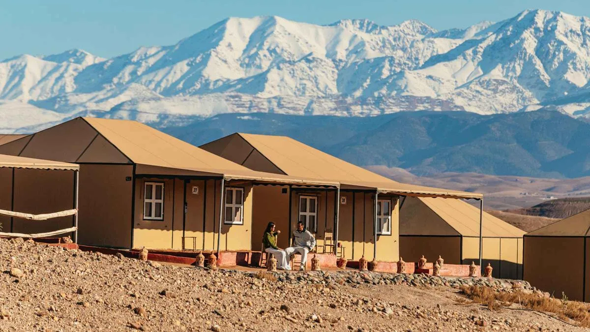 from $64.02
Marrakech: Agafay Desert Retreat, Tent, Dinner, Show & Pool
listed at $64.02
Overnight stay in a tented Agafay camp with pool access, dinner and a show, running 19 hours to two days. Unmarried Moroccan and Muslim couples cannot share a tent or dormitory.
Check AvailabilityPrices, ratings and details are the platform's own, checked in Q3 2026; dollar figures are the listed prices — the platform bills in your account's currency.
Agafay Is a Commune Before It Is a Desert
The single most useful correction on this page is administrative rather than scenic. Agafay is not an empty quarter and it is not in the province where most guides file it. It is a rural commune with a geographic code, a census return and neighbours, and knowing that changes how you read everything else about it.
The national statistics office lists the Commune rurale d'Agafay under geographic code 73510501, in the Cercle de Loudaya, in the Prefecture de Marrakech, not in the Province d'Al Haouz where a great deal of English-language writing places it. Its legal population at the 2024 census was 17,771 people in 4,213 households, of whom eight were foreign nationals. Ten years earlier the same commune counted 15,452, so it has grown by about fifteen per cent while the camps have gone up.
| Commune | Cercle and province | Residents, 2024 census | What it is to a visitor |
|---|---|---|---|
| Agafay | Loudaya, Prefecture de Marrakech | 17,771 | The ground the camps and the tracks sit on |
| Loudaya | Loudaya, Prefecture de Marrakech | 41,761 | The larger neighbour on the motorway side |
| Sid Zouine | Loudaya, Prefecture de Marrakech | 17,130 | Another commune of the same cercle |
| Ait Imour | Loudaya, Prefecture de Marrakech | 14,603 | Farmland between the city and the hills |
| Lalla Takerkoust | Amizmiz, Province d'Al Haouz | 8,419 | The dam and the lake, in a different province |
What That Means on the Ground
So when a camp describes itself as standing in the middle of nowhere, the nowhere in question has a town hall. The practical consequence for a visitor is small but real: there are villages, herds, school runs and farm tracks across the whole area, and the quad circuits that operators sell run through them. Drive as if you are on somebody's land, because you are.
The other consequence is that the national tourist board's silence is not a filing error. Agafay has no page on visitmorocco.com: both of the obvious addresses return the site's generic Places to go shell with no mention of Agafay in the body, and the only item about it anywhere on the board's Marrakech pages is a title in the video library. The one official body that does list Agafay as a tourism zone is the Al Haouz provincial tourist office, which is itself odd given the commune sits in the prefecture next door.
Populations, households and geographic codes from the HCP legal population, RGPH 2024, commune level, read in Q3 2026. The tourist board's silence was verified by fetching both candidate URLs on visitmorocco.com and searching the returned bodies for the word Agafay.
What the Ground Is, and the Two Words This Page Will Not Use
Almost every description of Agafay in English calls it a hamada or a reg, the two technical words for a stony desert. Both may well be accurate. Neither can be attributed to a source, and this guide does not print facts it cannot attribute.
We looked for an Agafay-specific geological description in the Moroccan ministry domains, in the open academic indexes and in the national research archives, and there is none. No paper about the geology of Agafay exists in OpenAlex, in Crossref or in the French national repository, and no Moroccan government page describes the terrain at all. The word hamada, which reads as authoritative, traces back through the guidebooks to nothing citable.
A French encyclopedia entry calls it a reg, sourced to tour operators.
What Can Actually Be Quoted
What can be quoted is narrower and duller and true. A 2024 peer-reviewed geography paper on tourism investment in the western High Atlas piedmont says of this exact area: 'This zone covering the communes of Tameslouht and Agafay has limestone soil not very suitable for agriculture but possesses great potential for tourism.' The same passage names what visitors come for: 'hiking in desert landscapes, quad biking and camel riding'. So the ground is limestone, it is poor farmland, and the phrase desert landscapes is used by a peer-reviewed source rather than only by a marketing one.
One layer down, a 2019 hydrogeology paper on groundwater in the western Haouz describes the structure beneath: 'geologically, the Palaeozoic substratum rise constitutes an obstacle for underground flow, which explains the low values recorded and measured around the studied area'. In plain terms, old rock rises close to the surface here and water does not move through it easily, which is a large part of why the country looks the way it does. Neither paper mentions dunes.
What It Looks Like When You Arrive
The practical version, for someone deciding whether to come: this is pale, dry, treeless hill country with hard ground underfoot, cut by dry watercourses, with the High Atlas standing behind it and snow on the ridge for part of the year. It photographs like a desert at the right hour and looks like rough pasture at midday. If you arrive expecting sand, the disappointment is not the landscape's fault.
Quotations from Ait Zamzami and others, Forum Geografi 38(1), 2024, pages 83 to 93, and from Sefiani and others, Irrigation and Drainage, 2019, doi 10.1002/ird.2363. The absence of any Agafay geology paper was checked in OpenAlex, Crossref and HAL in Q3 2026.
Getting to Agafay: 26.5 Kilometres, and Not One of Them on an Agafay Road
The drive is short and the roads are ordinary, right up to the point where they stop being roads. Here is what the national road register actually contains for this corner of the map, and what it conspicuously does not.
The Ministry of Equipment's traffic register numbers, measures and counts every classified road in Morocco. It has no Agafay entry. What it does have is the network around it, which is worth reading because the traffic counts tell you which approaches are busy roads and which are almost empty lanes.
| Road | Section | Length | Vehicles a day, 2023 |
|---|---|---|---|
| RP 2009 | Marrakech section, the corridor toward Amizmiz | not stated | 10,725 |
| A3 motorway | Marrakech Targa to Loudaya | 16.40 km | 8,837 |
| RR 212 | Marrakech to Tamesloht | 18.50 km | 5,016 |
| RP 2007 | Nationale 8 to Guemmassa | 14.30 km | 3,793 |
| RP 2020 | Guemassa to Lalla Takerkoust | 15.30 km | 338 |
| RP 2024 | Lalla Takerkoust to Moulay Brahim | 36.00 km | 471 |
Where the Classified Network Ends
The 2024 geography paper names the corridor in the same terms, describing tourism investment concentrated on the roads running from Marrakech 'towards Lalla Takerkoust dam and Amizmiz centre on provincial road No P2009'. That is the road you leave the city on. What happens after it is the part nobody documents: the tracks from those provincial roads to the individual camps are not in the classified network at all, which is why no source can tell you whether your hire car will manage the last kilometre.
The camp can, and it is worth asking before you book one.
The free-flow drive from Jemaa el-Fna to the Wikidata reference point for the desert is 26.5 km and about 35 minutes, computed on OpenStreetMap data for this guide. That is genuinely short, and it is the reason Agafay works as a half-day when nothing else on the day trips list does.
There Is No Public Transport
There is no public transport of any kind. CTM's stop register contains no Agafay, Tameslouht, Lalla Takerkoust or Amizmiz entry, and Supratours' 177-station list has none either. No official source names a grand-taxi stand for this direction and no shared-seat fare is published for it, so anyone quoting you a dirham figure is guessing.
In practice the choice is a booked trip with transport included, a taxi negotiated for the round trip and the wait, or your own car.
Road numbers, section lengths and 2023 average daily traffic from the CNER Recueil du Trafic Routier 2023, which contains no Agafay entry. Driving distance and free-flow time computed with the public OSRM routing service over OpenStreetMap data in Q3 2026. Carrier coverage checked against both operators' own station registers.
The Lake at Lalla Takerkoust, and the Only Hard Numbers Out Here
Fifteen minutes further on there is one structure in this landscape that a serious institution has measured, and it is a good half-day pairing with the hills because it is the opposite of them: water, in the middle of all that dry ground.
The United Nations agriculture organisation's dams database records the Lalla Takerkoust dam as operational since 1935, 71 metres high, holding a reservoir of 96 million cubic metres over an area of 0.6 square kilometres, and 27.6 per cent silted at the latest survey. It sits on the N'fis river, serves irrigation and hydroelectricity, and waters 9,800 hectares. Its coordinates put it 31.1 km from the city in a straight line and 35.6 km by road, about 38 minutes.
That silting figure is the one worth carrying. Better than a quarter of the reservoir's design capacity is now sediment rather than water, on a structure that has been in service for ninety years, which is the sort of fact that explains the shape of the shoreline you are looking at rather than decorating it.
The tourist board, which publishes nothing at all about Agafay, does publish about the lake: 'For a pure moment of happiness and tranquility, Lake Lalla Takerkoust offers you all the ingredients you need for a magical experience: soothing colours, breathtaking scenery in the fresh air.' It names jet ski and stand-up paddle for the water sports, and horseback riding and quad biking for everyone else. Worth noting that on the board's own Marrakech page the Lalla Takerkoust card links to nothing: the link target is a bare hash, so there is no page behind it.
The basin authority that would hold the operational detail, the Agence du Bassin Hydraulique du Tensift, could not be reached: its domain has no DNS record from outside Morocco and the national water ministry refused connections. So the reservoir level on the day you visit is not something any published source will tell you.
Dam dimensions, capacity, siltation and coordinates from the FAO AQUASTAT geo-referenced dams database, read in Q3 2026. The lake description is the Moroccan tourist board's own natural parks and lakes page. Road distance computed with OSRM over OpenStreetMap data.
How Much Time to Give Agafay
This is a destination with three honest lengths, and the difference between them is not how much of the landscape you see but how much of the evening you buy. All three are timed to sunset, because nothing here rewards the middle of the day.
The routings below use the operators' own stated durations. The drive is 35 minutes each way in every case, so the difference is entirely what happens once you are out there.
| Routing | What it covers | Door to door | What it skips |
|---|---|---|---|
| The short evening | Afternoon pickup, a camel ride along the ridge, the sunset, dinner and a show | About 4 hours | The quads, the pool and any daylight walking |
| The full afternoon | Quads on graded tracks with a briefing, then the camel ride, dinner and the show | About 7 hours | The sunrise, which is the better of the two light shows |
| The overnight | Dinner, the show, a tent for the night, the pool and the morning light | About 19 hours | Nothing, except a night you have already paid for in your riad |
Our own routing, if you are choosing between them: take the four-hour evening. It is the cheapest, it removes the least from a short city stay, and quad biking on graded tracks is the part of the package least worth the extra three hours. The overnight is the one genuinely different experience here, because the hills at first light are worth more than the same hills at dusk with fifty other people photographing them.
Whichever you pick, take a jacket. The operators' own listings say it flatly: the camps are exposed, and from November to February the temperature drops sharply the moment the sun goes. People arrive in what they wore in a 25-degree city and eat dinner shivering.
Durations, inclusions and the weather warnings are from the operators' own GetYourGuide listings, read in Q3 2026. No Moroccan authority publishes a recommended visit length for Agafay, or anything else about it.
Five Things Most Visitors Do Not Know About the Agafay Desert
Each line is a fact we could source, with the source in brackets. Where the finding is an absence, it is printed as an absence.
- Agafay is a legally constituted commune of 17,771 people with its own geographic code, not an empty quarter (HCP, legal population of the Kingdom, RGPH 2024, commune code 73510501).
- The national tourist board publishes no page about it: both candidate addresses return the site's generic shell, and the only Agafay item anywhere on its Marrakech pages is a video title (ONMT, visitmorocco.com, read in Q3 2026).
- It is in the Prefecture de Marrakech, in the Cercle de Loudaya, and not in the Province d'Al Haouz where most guides place it (HCP commune register, RGPH 2024).
- No geological description of Agafay exists in any indexed source. The nearest sourced statement is limestone soil unsuited to agriculture, in a zone whose attraction is described as desert landscapes (Ait Zamzami and others, Forum Geografi 38(1), 2024).
- The road register that numbers every classified road in Morocco has no Agafay entry, and the tracks that reach the camps are outside the classified network entirely (CNER, Recueil du Trafic Routier 2023).
The negative findings are the point of this page. Nobody publishes an entry fee, a permit, a managing body, a protected-area status, a road number, a public transport service or a geological classification for Agafay. It is one of the most photographed places near Marrakech and one of the least documented.
In the Agafay: What to Do, and What Not To
Every line here is argued somewhere above, compressed into what you decide on the afternoon itself.
Do
- Book the afternoon slot, not a morning one: everything out here is built around sunset and midday light flattens the hills completely
- Take a jacket even in a warm week, because the operators' own listings warn that the camps are exposed and the temperature falls the moment the sun goes
- Ask the camp what the last kilometre of track is like before you drive yourself, since none of it is in the classified road network
- Pair it with the lake at Lalla Takerkoust if you have a car, 35.6 km out, for the one thing near here that anybody has measured
- Take the four-hour evening if the city stay is short, because it costs the least day and the least money
Don't
- Don't come for sand. The dunes are at Merzouga, 553 km east, and this is limestone hill country
- Don't repeat the hamada or reg label as though it were established, because no official or academic source uses either word for this ground
- Don't expect to arrive by public transport: neither national carrier lists a stop within reach and no shared-taxi fare is published
- Don't treat the quad circuits as empty country, since they cross the farmland of a commune of nearly eighteen thousand people
- Don't book the overnight for the price of a hotel room, because you are also paying for the riad night you are not using
Agafay Desert Map: The Hills, the Dam and the City
The reference point for the desert, the reservoir a quarter of an hour further on, and the two things people confuse this landscape with. Coordinates are the Wikidata reference points, except the dam, which uses the coordinates in the United Nations dams database.
Pin coordinates are the Wikidata P625 values for Agafay, Sti Fadma, Imlil and Jemaa el-Fna, and the FAO AQUASTAT coordinates for the Lalla Takerkoust dam. Verified in Q3 2026.
Where to Go Instead, or Next
The three destinations people weigh against an Agafay evening, with the line that separates them.
Merzouga and Erg Chebbi
The actual Sahara, and the reason this page keeps saying Agafay is not it. No scheduled service returns the same day and one carrier does not serve it at all. The Merzouga page proves that from the timetables rather than asserting it.
553 km east, three daysOurika Valley
Water, walnut terraces and a waterfall path, on the opposite side of the city and for less money. The Ourika page carries the road, the real distance and the flood record that shapes where you sit down to eat.
62.7 km, about 1 h 21Atlas Mountains
Toubkal National Park, created in 1942, with about 40,000 visitors a year and no published entry fee. The Atlas page has the refuge tariffs and the compulsory-guide question nobody can answer.
The ridge you can see from the hillsAgafay Desert Questions
Is the Agafay Desert worth going to?
For an evening, yes, and for the reason nobody advertises: it is 26.5 km from Jemaa el-Fna, which makes it the only landscape near Marrakech you can reach and return from in half a day. As a desert it will disappoint anyone expecting sand, since it is limestone hill country. Take the four-hour sunset trip at $16.59 and treat it as an evening out rather than an expedition.
Is Agafay the same as the Sahara?
No. The Sahara dunes Morocco is known for are the Erg Chebbi at Merzouga, 553 km east and three days away by any realistic routing. Agafay is a limestone hill country commune half an hour from the city with no dunes at all. The Merzouga page sets out what reaching the real dunes actually involves.
What country is the Agafay Desert in?
Morocco. Specifically, the Commune rurale d'Agafay sits in the Cercle de Loudaya, in the Prefecture de Marrakech, in the Marrakech-Safi region, about 26.5 km south-west of the city centre. It is not in the Province d'Al Haouz, where a good deal of English-language writing places it.
Can you stay overnight in the Agafay Desert?
Yes, in a private camp, and it is the one version of the trip that shows you the hills at first light rather than only at dusk. The overnight with a tent, dinner, a show and pool access is listed at $64.02 and runs about nineteen hours. No authority regulates or classifies these camps, and none publishes a rate card, so the platform listing and the camp's own site are the only prices in the open.
How far is the Agafay Desert from Marrakech?
26.5 km by road from Jemaa el-Fna to the reference point for the desert, and about 35 minutes at free-flow speeds, computed on OpenStreetMap data for this guide. The Lalla Takerkoust dam nearby is 35.6 km and about 38 minutes. No Moroccan authority publishes a road distance, because the road register contains no Agafay entry at all.
Is there an entry fee for the Agafay Desert?
No. No Moroccan authority publishes an entry fee, a permit, an access charge or any protected-area status for Agafay, and there is no managing body to collect one. What costs money is the vehicle, the camp and the activity, all priced privately. The ways of getting there are compared above.
Can you get to the Agafay Desert by public transport?
No. Neither national coach operator lists a stop at Agafay, Tameslouht, Lalla Takerkoust or Amizmiz, and no official source names a grand-taxi stand or fare for the direction. That leaves a booked trip with transport included, a taxi negotiated for the round trip, or your own car. The day trips comparison shows which destinations do have a timetable.
Where an Agafay Evening Fits in a Marrakech Trip
One line of routing, and the argument for it.
This is the half-day for the afternoon you have left over, not a day trip in the sense the other seven destinations are. It works best on the day you arrive late or the day before you fly, because it starts after lunch, it asks nothing of your morning and the drive is short enough that a delay costs you nothing. On a three-night stay it is the only trip out of the city that does not cost you a whole day of the city.
It also works as the compromise when the heat has beaten you. In July and August the long drives are punishing and the walking days start to look like a bad idea, and an evening on a ridge with a breeze and dinner is the version of Morocco that still functions at 40 degrees. If you want the mountains properly, Imlil is the trailhead; if you want the whole comparison, every destination is set against drive time and fare; and the city list itself is on the Marrakech guide homepage.
The Agafay on Film: The Drive, the Camps and the Ridge at Dusk
Three films that show what the ground actually looks like at different hours, which matters more here than anywhere else near the city, because the landscape at noon and the landscape at sunset barely look related.
Day Trip to Agafay Desert from Marrakesh Sep 2025
A plain run through the standard afternoon, useful for judging how much of it is camp and how much is landscape.
Video: Little BeastAn Epic Guide to the Agafay Desert
The tourist board's own video, and the only Agafay item that appears anywhere on its site, which is the negative finding of this page in visual form.
Video: Visit_Morocco_Quad bike & camel ride tour in Agafay desert
The quad circuit and the camel line filmed on the tracks themselves, worth watching before you pay the extra three hours for them.
Video: Chameau- MarrakechVideos load from YouTube only when you press play.
Reviewed Q3 2026 (July–September 2026); next review Q4 2026. Prices, hours and terms are set by the venue or operator and confirmed at checkout.
We may earn a commission if you book through one of our links, at no extra cost to you. Full affiliate disclosure